Geomaticx Service
GIS Service
The company provides its best service in the field of GIS technology. Though not being a product developer or reagent, it works for the digital data conversion, attribute generation, database management in GIS, data analysis in some extent etc. The company works with the latest technology in the market and efficient manpower in hand to achieve the best result. So it has been evident with the prior exposure that the advancement of the GIS technology with the help of analysing the project execution process and continuous R&D has been the main motto of the same.
Digital Cartography
The company lays its great contribution in the field of digital cartography. The work of generating digital map from hard copies and vice versa has been a matter of aesthetic to the company. The company with its skilled and experienced manpower and its excellent understanding of present days cartographic thirst of the client is engaged in producing good quality cartographic maps according to the demand of the clients. It is also engaged in the continuous R&D to exaggerate the aesthetic of the cartographic maps.
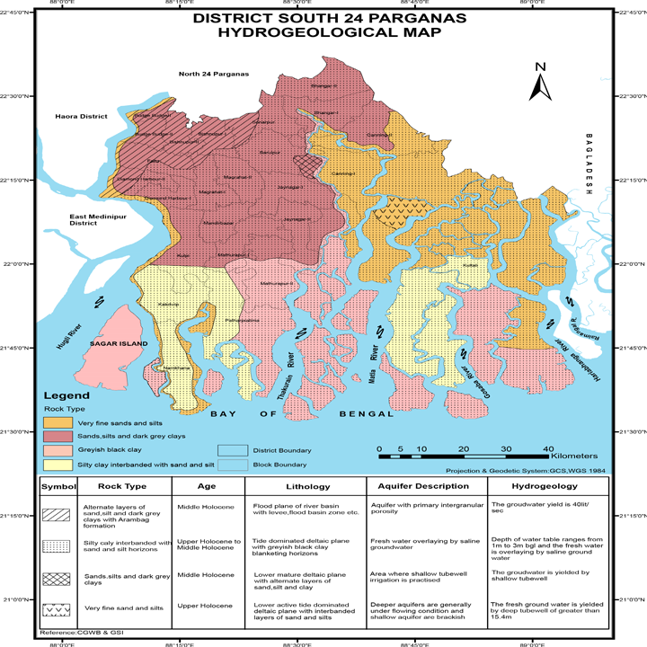
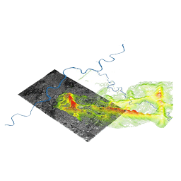
Image Analysis
The company aims in contributing in the field of digital photogrammetric works. The company works with the prior exposure with clutter class extraction, image interpretation and rebuilt urban class generation. To leverage the scope of this field, the company has retained expert image analyst for the future projects.
GPS & DGPS Survey
The company has much exposure in the field of GPS Survey with the handheld high precision GPS technology. With great precision and technical understanding of the GPS survey, the company has gained a great impression to the corporate giant like Here Map Solution. Besides GPS survey, the company aims in leveraging its exposure in the field of DGPS survey also.

Web Development
The company works in the field of developing websites of various organizations. With its skilled manpower, the company has developed excellent web portals of various clients alongwith its own. The company is now engaged in continuous R&D with the Web GIS so as to facilitate the best WebGIS services to the people.
Education
The least but not the last contribution of the company is to spread GIS education to the people. Though it is not a voluntary or NGO work but the company aims to execute certificate courses for various students and professional in nominal remuneration. The company also aims to provide internship alongwith live projects to the students pursuing the higher degree.

Geoinformatics Training
We provided short term training courses on various parts of geoinformatics.The general certification on Geoinformatics pertaining to the GIS,Reomote Sensing and GPS survey has wide applicablity in geospatial industry.The proforma and the schedule may be availed directly from the Geomaticx office.The training courses are theory and practical based with real time project exposure.

Construction Work
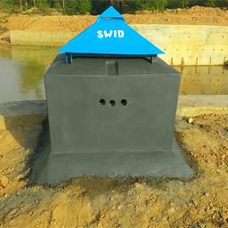
We have a great exposure on civil and hydrological construction of Manual and Automatic Stream Gauges establishments.We are also engaged in DWLR (Digital Water Level Recorder) protection works.The organization has expertise in hydrological construction works.
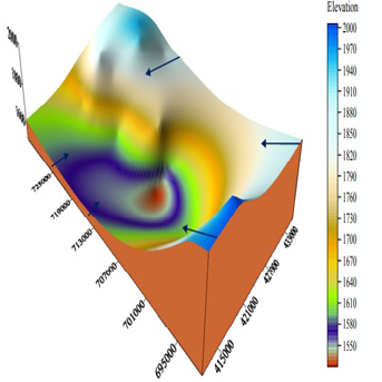
Hydrology Project
Geomaticx thrives on intensive as well as extensive Research & Development to excel in the service sector. Innovation at Geomaticx is backed by strong Hydrological, Hydrogeological, Hydraulics, Climate Science and Water Science expertise and the knowledge bank created over the years. State-of-the-art research lab with mathematical & numerical modeling facility supported by well qualified and experienced R&D team, and use of advanced numerical and computational models and technologies is the core of development of new approaches, methodologies and techniques resulting in high quality technological services. The Company’s effectiveness lies in its unique offerings of state-of-the-art design and solutions. We are engaged in continuous improvement of design and management parameters to enhance the quality of services and cost competitiveness in order to build value for our customers.
LiDAR Project Collaboration
Light Detection And Ranging can be done in several remote places quite fast (250 sq Km./day fly),with an accuracy of 10cm.
We have expertise to run with Airborne Technology in Western districts,i.e. Burdwan,Bankura,Purulia,East and West Midnapur(Where clear geographical topography is needed).
Our focus is to gather accurate spatial data and make a clear planning of use of natural resources in a sustainable way.
Geomaticx is also equipped with Mobile LiDAR for the Navigation and other ground base Survey with 8mm. precision.
The organization is now fetching the hydrological monitoring with the LiDAR technology.The volumetric analysis of river water and the surface area monitoring of a river basin may be done with the LiDAR technology.

R&D
The most advanced engagement of the company is to its R&D works in the all disciplines in the aforementioned sections. Other than the R&D in the respective fields, the company aims to execute different R&D project with great assistance with NGO,IIT delegates and Professors of different universities to proliferate the Geospatial Technology for the well being of the society.